Can multi-date, multispectral satellite imagery discriminate severity classes of Spruce Budworm defoliation?
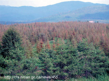
Insect defoliation is a natural disturbance which affects roughly 90 million cubic meters of timber volume in Canada each year 1. Eastern spruce budworm (Choristoneura fumiferana) accounts for 40% of annual volume loss thus essential to identify when assessing the health and productivity of Canada’s forest. Due to the vast spatial extent of infestations, it is necessary to obtain information that bridges the scale gap between plot based measurements, aerial surveys and stand characteristics.
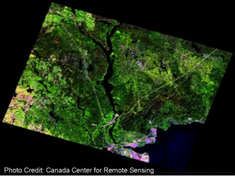
Multispectral satellite imagery provides information useful for identifying spruce budworm outbreaks. The ability to obtain temporal data over large areas provide a cost-effective means of assessing the current and cumulative impact defoliation has on the health of Canada's forest.
